Hummingbird – Faulty solar panel detection from drone images
Overview
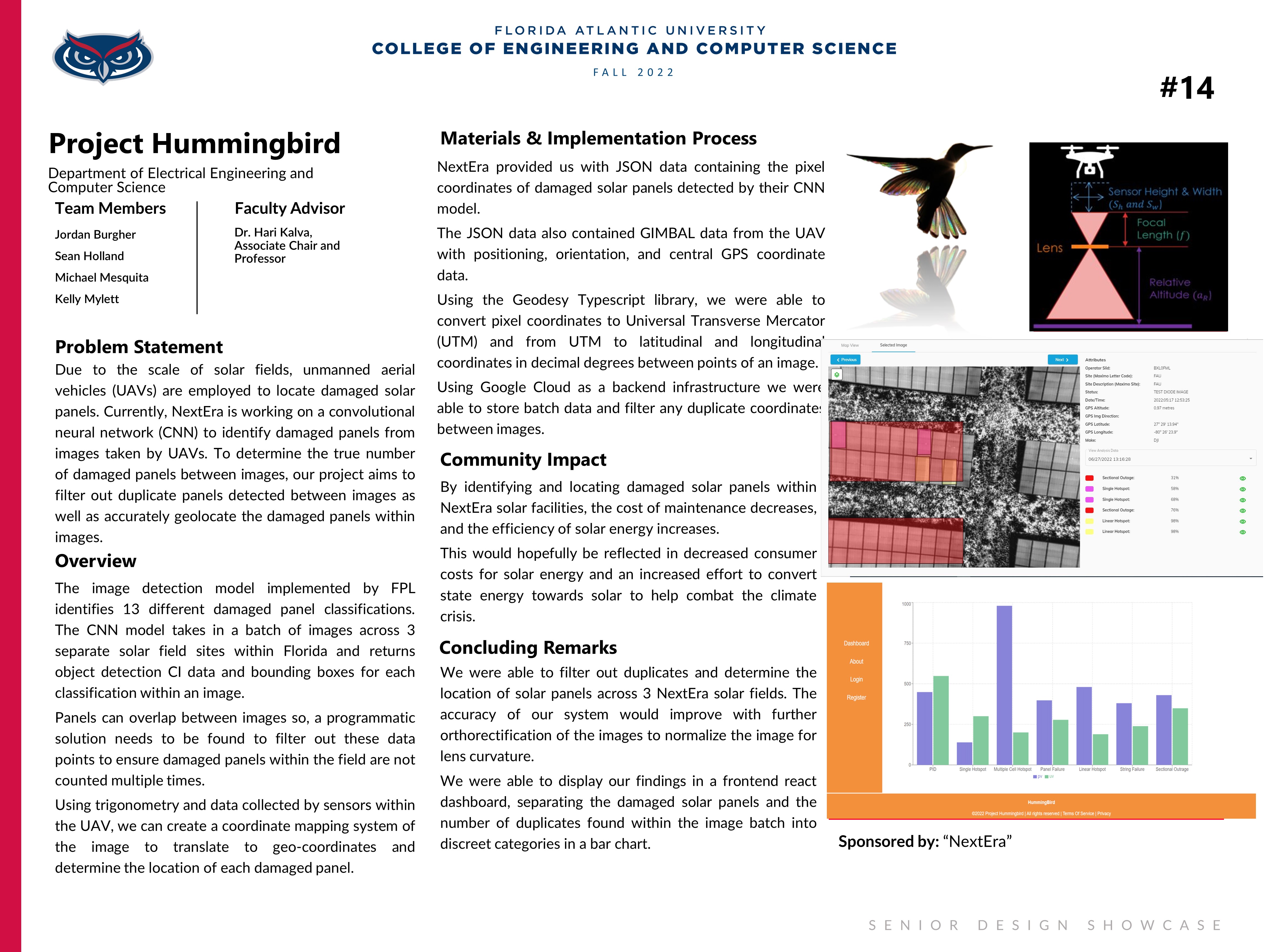
Our project's objective is to determine accurate locations and counts of damaged photovoltaic panels within solar plant facilities. Damaged panels are detected manually using infrared cameras and unmanned aerial vehicles (UAV). Images are classified with a machine learning (ML) model to classify and bound damaged panels within an image. The gimbal metadata provided by the UAV and the data associated with the ML model allows our system to accurately predict the geo-coordinates of broken panels within images. Our system also allows us to check for the locations of panels between images and allows us to disregard previous occurrences of the same panel when found. The results from our analysis are stored and displayed in a secure database and web portal, allowing the user to view summary statistics on the number of panels with defects, types of defects found, and the location of these panels over time.
Community Benefit
Optimizing monitoring and repair time, makes utility level solar fields more efficient and therefore more cost effective. Increasing the viability of solar energy as a sustainable renewable energy source and therefore combating the climate crisis.
Team Members
Sponsor
NextEra