10/30/2023
New Offshore Research Buoys
Filling the Gap in Ocean Data Off Florida’s East Coast
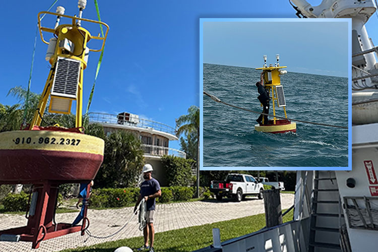
Scientists from Florida Atlantic University’s Harbor Branch Oceanographic Institute recently helped install meteorological and oceanographic buoys offshore of the Ponce de Leon and Fort Pierce inlets – filling prominent gaps in data for these areas and providing critical infrastructure for placement of environmental sensors for basic and applied research.
The buoys are an expansion of an existing oceanographic observing network along the Atlantic coast operated by project partner University of North Carolina at Wilmington (UNCW) Coastal Ocean Research and Monitoring Program (CORMP) and funded by the Southeast Coastal Ocean Observing Regional Association (SECOORA). FAU Harbor Branch was tapped by Lynn Leonard, Ph.D., professor of geology and director of CORMP, as a local partner to provide expertise and logistical assistance for the buoys’ placements, as well as ongoing monitoring and maintenance of the buoys. The buoys measure air temperature, relative humidity, barometric pressure, wind speed and direction, sea surface temperature and salinity and depth. The Ponce de Leon site also includes a wave data buoy, which measures wave height, period and direction. Data management is supported through a partnership with Second Creek Consulting, LLC.
The buoy off the Ponce de Leon inlet is located roughly 16 nautical miles due east and fills a prominent gap in weather and wave data for this region, which includes New Smyrna Beach and Daytona Beach. Previous to its installation, scientists and meteorologists depended on simulated computer modelling to predict the intensity and timing of incoming weather and ocean conditions. Now, the data is collected and relayed in real time to CORMP and published publicly on the CORMP, SECOORA and National Oceanographic and Atmospheric Administration websites. The second buoy is located approximately 10 nautical miles northeast of the Fort Pierce inlet and augments an existing wave buoy situated about five miles offshore.
In addition to oceanographic research, the data will be used by the National Weather Service in Melbourne to increase the reporting accuracy of coastal weather conditions, alerts and warnings.
“The buoys have been strategically placed to provide advance information on ocean conditions,” said Jordon Beckler, Ph.D., assistant research professor at FAU Harbor Branch and a faculty fellow at FAU’s Institute for Sensing and Embedded Network Systems Engineering. “This data is important to researchers and weather forecasters, but we also encourage the general public to utilize the information so they can make better decisions about whether or not to go offshore.”
Mariners in the area should mark the buoy positions and take precautions when navigating the area to avoid collisions. The buoys are equipped with yellow flashing lights and radar reflectors to aid mariners in their detection at night.
“The Geochemistry and Geochemical Sensing Lab at FAU Harbor Branch will be on the water maintaining the sensors and will provide a local presence to create awareness of the buoys and foster connections with scientific and community stakeholders,” Beckler said. “Beyond the data itself, the physical buoy, power and communications infrastructure is valuable to other scientists seeking to co-locate additional sensors offshore for fundamental or applied research.”
For instance, the buoys are ideal locations for installing water-quality sensors to help determine if coastal discharges travel offshore and affect ocean health. Sensors could also be placed to study seasonal ocean dynamics such as the correlation between nutrient upwellings and fish migration.
Data from the buoys is available to the public at www.cormp.org, portal.secoora.org, and www.ndbc.noaa.gov.