Dr. Hongbo Su was invited to give a talk on "Sea Wall detection from aerial images using machine learning"
Friday, Nov 18, 2022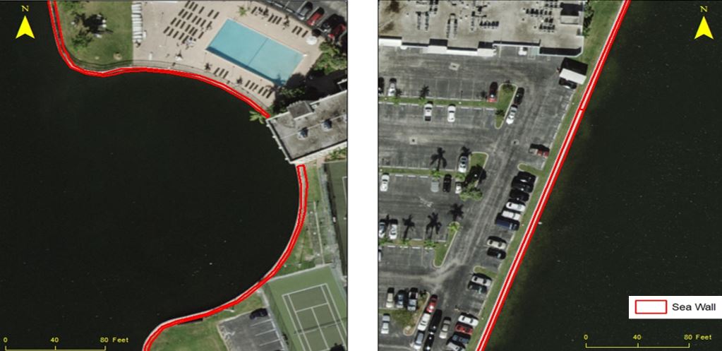
Dr. Su was invited to talk about "Sea Wall detection for coastal area from high resolution aerial images using machine learning"on the International Conference on Geospatial Information Science: Education, Innovation and Applications held by Wuhan University on Nov. 11, 2022.
Eight of the top ten largest cities in the world are located by the coast. Over half the world's population lived within 200km of a coastline.
Seawalls can minimize the consequences of heavy waves in storms and hurricanes, and they can offer a fairly sturdy defense against tsunamis. In fact, seawalls built in place for over a hundred years are still doing their job.
This research use a Remote Sensing High – Resolution Aerial Imagery collected from South Eastern Florida Coast to automate the detection of Seawall using Machine learning and OBIA (Object-based image analysis).
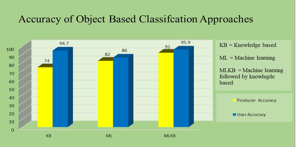
Of all the methods, machine learning followed by a knowledge-based approach gave the best result. The misclassified objects in the machine learning approach were accurately reclassified by setting the rule sets in a knowledge-based approach. The method is efficient in terms of accuracy and time.
Among the three Machine learning algorithms used, Random Forest gave the best Overall accuracy of 85% Similarly, the Producer accuracy was 84% and User accuracy 88% for Sea Wall Classification.
More about the sea wall detection method can be found from a recent journal article:
Paudel, Sanjaya, Hongbo Su, Sanju Khatri, and Sudhagar Nagarajan. "Seawall detection in Florida coastal area from high-resolution imagery using machine learning and OBIA." Journal of Applied Remote Sensing 16, no. 1 (2022): 012016.
or from this QR code: