Clewiston CRS Plan
Abstract
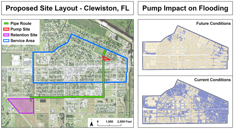
The City of Clewiston is a small rural community on the south side of Lake Okeechobee which has limited flood protection or planning. The goals of the is project is for three geomatics students, one civil engineering student, and one environmental engineering student to work as a multi-disciplinary team to develop a plan to address these issues. The effort discussed herein focusses on the scanning tool that combines readily available data on topography, ground and surface water elevations, tidal data for coastal communities, and rainfall, to develop a planning level framework that permits investigators to target the optimal set of outcomes for a given community. This framework appears to be viable across communities that may be flush with water due to sea level rise, rainfall, runoff upstream and other natural events. This data is needed to help identify the issues needed for the City of Clewiston to create an acceptable flood management plan. Our plan focuses on the issues required for Community Rating System (CRS) definitions. Clewiston will be the first inland community to test the template.