Research on Tidal Flats is ‘Wake Up Call’ for U.S. Coastal Communities
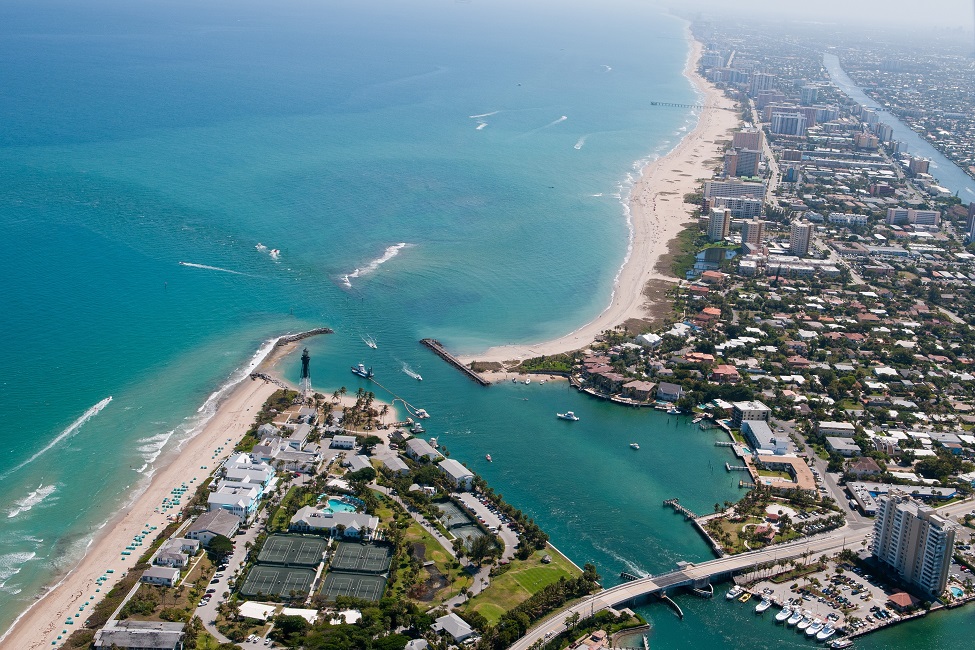
About 41 million people live in U.S. Atlantic coastline counties. This high population density poses a critical challenge to sustainable developments in coastal areas.
About 29 percent of the United States’ population live in coastline counties – more than 41 million are in Atlantic counties. This high population density poses a critical challenge to sustainable developments in coastal areas.
Tidal flats, which make up coastal wetlands, are facing unprecedented challenges because of increased human activities. They are widely recognized as sentinels of coastal environment change. Importantly, they are the guardians for beachfront communities as they can largely mitigate destructive forces from the ocean. Without them, coastal communities are more vulnerable.
Currently, there isn’t an effective way to identify and quantify the interactions between urban areas and tidal flats, which is essential to preserve the nation’s coastal communities. Moreover, existing research is limited to individual cities, which doesn’t provide the big picture.
To address this environmental crisis, researchers from Florida Atlantic University have developed a novel approach that quantifies change patterns of tidal flats from a spatiotemporal perspective using data collected across time. Their study is one of the first to investigate correlations between tidal flats and urban areas using this technique.
For the study, researchers selected and analyzed the annual dynamics of three highly urbanized coastal counties in the southeastern U.S., which represent unique environmental settings: a tidal flat system of more than 3,168 square kilometers characterized by numerous sounds, estuaries, as well as the twice-daily ebb and flow of the tides.
They separately assessed the spatiotemporal dynamics of tidal flats and urban areas in the counties of Charleston, South Carolina; Chatham, Georgia; and Duval, Florida between 1985 and 2015. They then identified and quantified the tidal flat losses in these three counties, which are directly or indirectly associated with urban expansion, from a geographic lens that focused on place and space.
Results of the study, published in the international journal, Earth , verifies and highlights the conflicts between intensified human activities and coastal environments. Importantly, this new approach can be revised and applied to the entire U.S.
Findings showed that tidal flats are under pressure from urban expansion from both the eastern and western sides. In particular, the western side has been rapidly urbanized during the three decades, giving Duval County the largest new urban areas within 2 kilometers of the coast. Duval County has experienced more erosion and urban growth than the other two counties and also has much smaller tidal flats than the other two counties. It has the largest newly urbanized area toward the seashore. Compared with the two other counties, Duval County also has a less stable environment of tidal flats, which calls for a higher level of public awareness and concern.
Meanwhile, some suburbs in the two other counties also have been rapidly urbanized, including the eastern and western wings of the City of Charleston and southwestern side of the City of Savannah. These urbanizations also would considerably affect the surrounding tidal flats, and the closer places would receive higher environmental pressures.
In observing the spatial overlaps between new urban areas and tidal flat erosions, the researchers found that the constant shrinkage of tidal flats is hysteretic (has lagging effect) to the accelerated process of urbanization in the coastal area. This hysteresis effect also exists in the restoration and management of ecosystems, and severe damages could result in irreversible changes.
“It takes time to observe the follow-up ecological effects of urban expansion in recent years. Based on our research, the tidal flats in these three counties urgently need a sustainable plan of management in response to the rapid expansion of urban areas,” said Weibo Liu, Ph.D., senior author and an associate professor, Department of Geosciences, within FAU’s Charles E. Schmidt College of Science. “The conflict between human beings and the coastal environment immediately calls for public awareness, as well as effective collaborations between lawmakers, scientists and local authorities.”
Findings from the study show that Charleston County has the largest tidal flats (544.87 square kilometers on annual average), followed by Chatham County (343.46 square kilometers on annual average) and Duval County (89.49 square kilometers on annual average).
Interestingly, in every individual county, the area shares of urban growth and erosion are considerably close to each other. This means that urban expansion and erosion in the early years would be greatly offset by erosion and urban expansion in the following years, and would therefore not significantly impact the overall area of tidal flats for a long period of time.
“Urban expansion is regarded as one of the major anthropogenic threats to the environment of tidal flats,” said Chao Xu, first author and a Ph.D. candidate, FAU Department of Geosciences. “While it is challenging to stop the inundation process driven by sea level rise, a more practical solution would be to limit urbanization near the shoreline. This way, tidal flats would be more flexible to migrate toward the inland area.”
For the study, researchers used a 30 meter spatial resolution annual map collection of urban extents in the conterminous (sharing boundaries) U.S. from 1985 to 2015; a 30 meter spatial resolution annual map collection of tidal flat areas in the conterminous U.S. from 1984 to 2020; and a shoreline shapefile (the highest detail coastline data) provided by NOAA. This created a two-sided distance buffer of 2 kilometers along the coast, which made it easier to identify, quantify and analyze the interactive dynamics between urban areas and tidal flats.
-FAU-
Tags: faculty and staff | students | research | science