Immersed by Future Sea Levels
By Wynne Parry
The encroachment of the ocean onto land is often described in dry terms, such as inches of water, or as lines on charts and maps. But FAU researchers are looking at more visceral ways to illustrate the potentially water-logged future.
Using immersive technology, such as virtual reality, a team led by John Renne, Ph.D., director of the Center for Urban and Environmental Solutions, is creating a three-dimensional model of streetscapes inundated by water at depths that experts warn may arrive in the coming decades.
“They say a picture is worth a thousand words,” Renne said. “We hope to use that philosophy to move into better conversations about how we can respond and adapt.”
Funded by the U.S. Department of Transportation, with collaboration from FAU’s Florida Center for Environmental Studies, Louisiana State University, the Illinois Institute of Technology and the University of Arkansas, the project seeks to develop a new tool to aid planning efforts by helping people better visualize and comprehend how rising water could affect their communities.
Increasing sea levels are a consequence of global warming, which scientists have concluded melts ice sheets and glaciers, and causes the oceans to expand as they warm. Low-lying parts of South Florida are already seeing more flooding, although the full impact will take decades to materialize, Renne said.
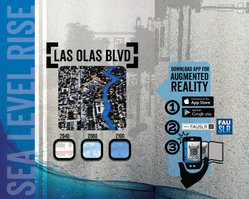
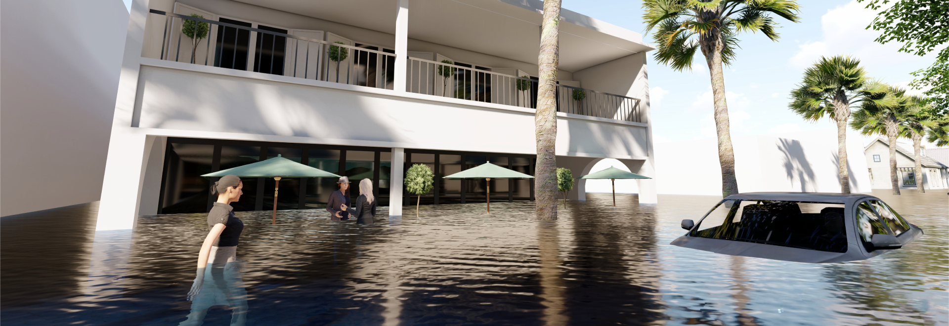
To bring this abstract threat home, Renne’s team focused on the future of a current two-block stretch of Los Olas Boulevard in downtown Fort Lauderdale. The team took 360-degree photos of the shops, galleries and greenery along the boulevard, which is located north of the New River, a tidal waterway that flows into the Atlantic Ocean. Using a variety of software packages deployed by architects, urban planners, engineers and video game programmers, the team superimposed the imagery in three dimensions and added a rendering of rising water.
Their simulation of the two-block stretch in the year 2060 shows life continuing unchanged. However, two decades later, water is depicted blanketing the street and door steps of Los Olas Boulevard. In 2100, the area around the New River is projected to be under up to 37-inches of water, with people standing in waist-deep water.
Using virtual reality, this preliminary effort required that the user be immersed in an artificial environment with goggles and sometimes headphones. Other visualization alternatives are being explored, including augmented reality, in which special glasses add virtual objects to a view of the real world.
“Eventually, we would like to create an app that would allow you to scan your environment with your phone, and see exactly where the water would be,” Renne said. “We are trying to figure out the most cost effective, user friendly way to visualize the future.” Renne hopes that immersive visualizations might help to prevent the most devastating consequences here by spurring people to think about ways to prepare and adapt.
“This will happen over the next couple of generations,” Renne said. “The quicker we start to address it and do something about it, the better off we will be.”
If you would like more information, please contact us at dorcommunications@fau.edu.